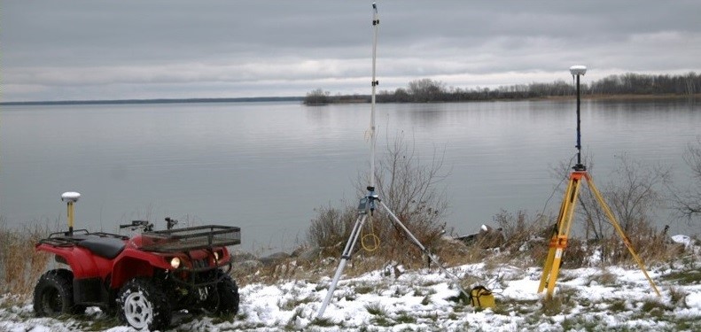
TOPOGRAPHIC SURVEY
At AAE, we offer comprehensive land surveying services that are tailored to meet the needs of our clients’ specific projects. Our powerful, state-of-the-art Trimble R8 GNSS survey system enables us to perform land surveys with a high level of precision and accuracy and produces detailed, high resolution topographic profiles that have served our clients for watershed and drainage planning, site assessments, hydrological modeling, flood mitigation, and much more.
For some examples the surveying services we have and can provide, please refer to our representative projects below, and do not hesitate to contact us if you require information about how our surveying capabilities can work for you.
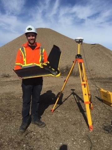
AERIAL/ DRONE SURVEYS
AAE prides itself on incorporating advanced technologies into our practices to provide high quality, innovative and cost-effective environmental services. Our fully autonomous eBee fixed-wing unmanned aerial vehicle (UAV) is equipped with high precision GPS, ground and wind sensors, a high definition camera, and combined with our Trimble RTK ground system, allows us to conduct aerial surveys and produce Digital Surface Models (DSM) of any site.
By combining our UAV capabilities with our valued partnerships and expertise in hydrology, bathymetry, GIS and engineering, we are able to provide unique solutions to your environmental needs. Please do no hesitate to contact us if you require information about how we can meet your project needs, or refer to our surveying brochure.
BATHYMETRY
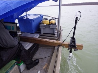
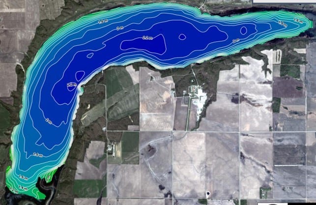
Bathymetric surveys provide valuable information about the depth, shape, surface area and volume of a water body. This information can be useful in assessing the quantity and quality of aquatic habitat and for applications in sediment monitoring, vegetation control, discharge analysis, as well as in feasibility studies of environmental compensation measures, such as dredging, among others.
AAE uses state-of-of-the-art BioSonics MX Echosounder technology and combines this with our Trimble RTK positioning system to produce highly accurate, geo-referenced bathymetric data. Our technology and expertise enable us to provide detailed bathymetric maps, as well as maps of substrate composition and submerged vegetation coverage, height and biovolume.
GIS AND MAPPING
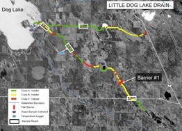
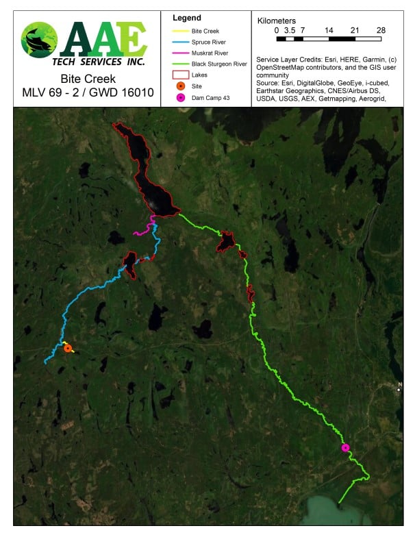
All environmental projects typically have a Geographic Information System (GIS) component. GIS is a critical tool for mapping watersheds, substrate classifications, recording bathymetry and is a key component utilized for telemetry studies. GIS mapping offers decision makers the information necessary for the maintenance of healthy ecosystems with regards to habitat enhancement, creation or rehabilitation.
Geographic Information Systems (GIS) play an increasingly critical role in environmental research, development planning and resource management. AAE uses state-of-the-art mapping and GIS tools to complete a wide range of projects, including aquatic and terrestrial assessments; water-shed planning and flood mitigation studies; aerial, topographic and bathy-metric surveys; project feasibility studies and more. AAE’s GIS and map-ping capabilities provide clients with the information necessary for efficient project development and accurate decision-making.
SPATIAL ECOLOGY
Spatial Ecology is the tracking of animals movements over distance through the method of Acoustic Telemetry. It contains two main compo-nents: a transmitter and a receiver. The transmitter releases a set of sound pulses that are then detected by the receiver. Once detected the receiver logs the information, date and time of the detection. Transmitters can be implanted or attached to a fish, which is then released back into the water. The transmitter allows the receiver to track the location of the fish as it swims, allowing researchers to determine how much time a fish spends in one area.
AAE’s staff has the equipment, capability and understanding to deploy transmitters in order to track fish populations. This type of method can allow you to have a better understanding of fish populations for fish management and population control.